Projects
Discover the many projects already using the VtWeb Framework...
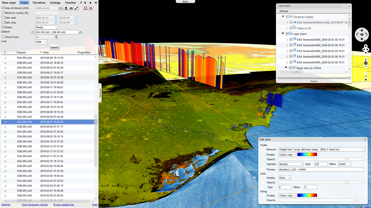
VtWeb
Client-server system allowing to scan free data from the Web, to visualize them in 2D/3D in all browsers, to process them on the fly, to share and to export the selected data.
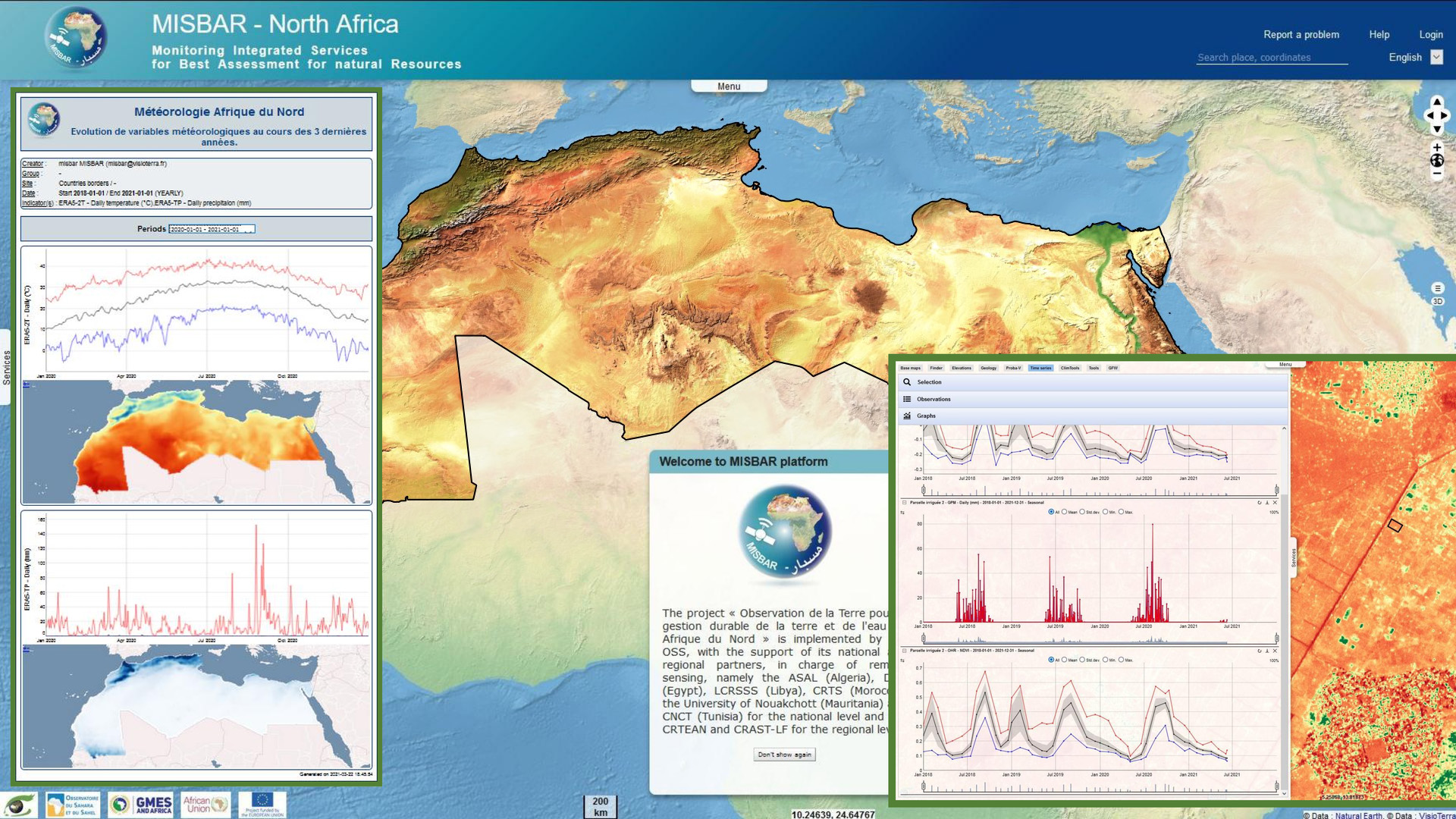
MISBAR
In the framework of the GMES&Africa programme, VisioTerra supported AfEOS in the development of indicators, dashboards, periodic bulletins and configured a datacenter for the Sahara and Sahel Observatory (OSS).
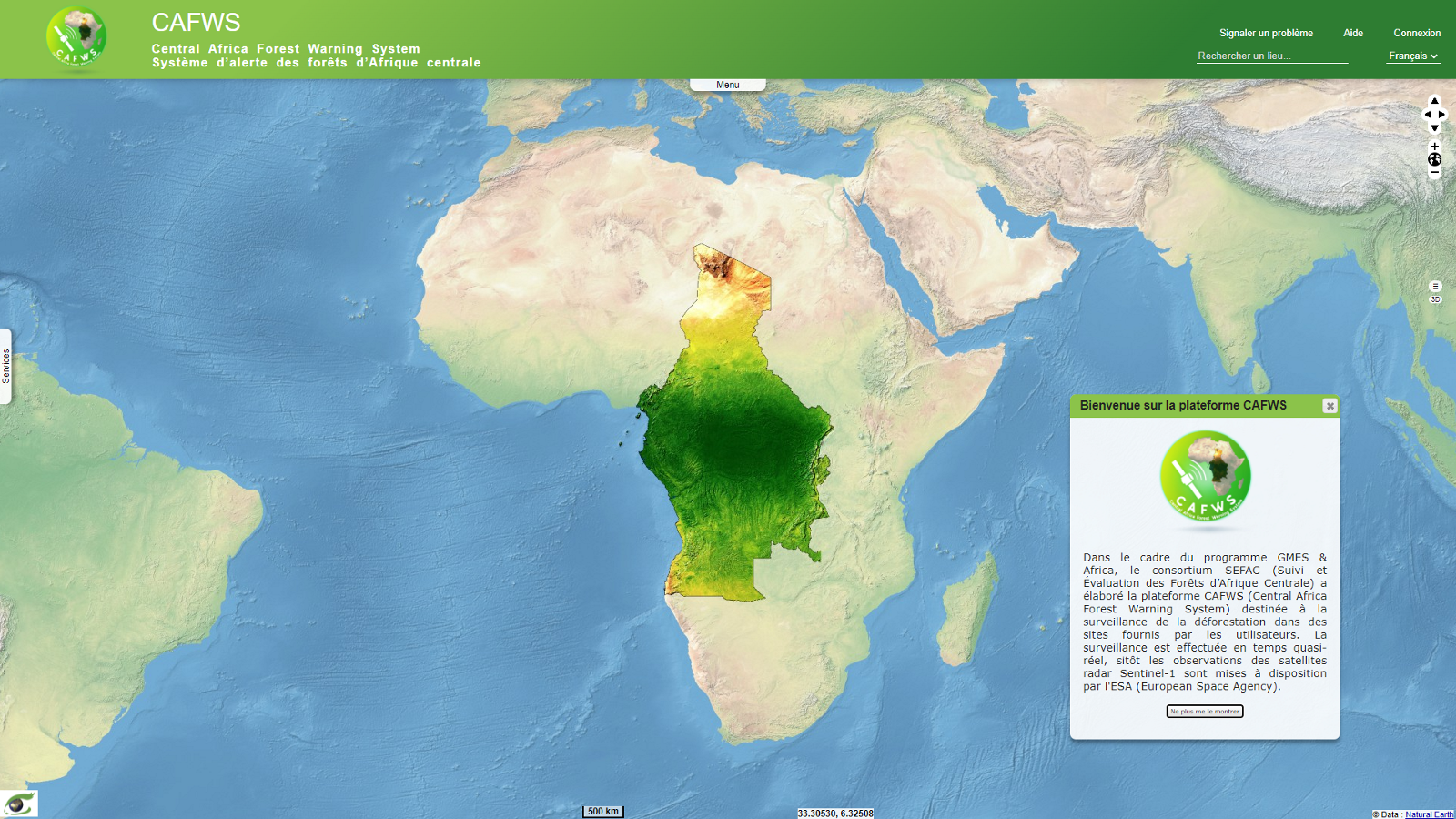
CAFWS
Within the framework of the GMES&Africa program, the SEFAC consortium has developed the CAFWS (Central Africa Forest Warning System) platform for monitoring deforestation in sites provided by users.
SVP
Daily edition of ’Stories’ (’Sentinel of the Day’ and ’Event Sheets’) showing the potential of Sentinel-1/2/3/5P images and altimetry data.
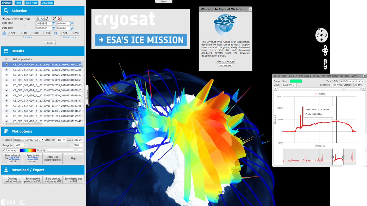
VtCryoSat
Client-server system allowing to scan, visualize, share, export and choose the rendering of the altimeter data on board the ESA CryoSat satellite.
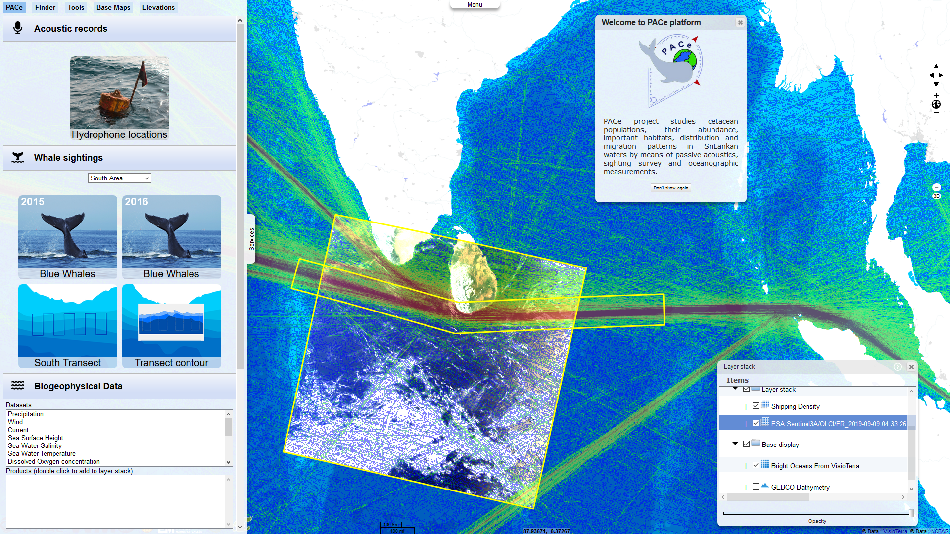
PACe
The PACe Project (Population Assessment of Cetaeans in Sri Lanka) tries to combine data resulting from passive acoustics (World Maritime University) with analysis of satellite imagery to examine the oceanographic features that may influence the distribution of the blue whales off the southern coast of Sri Lanka
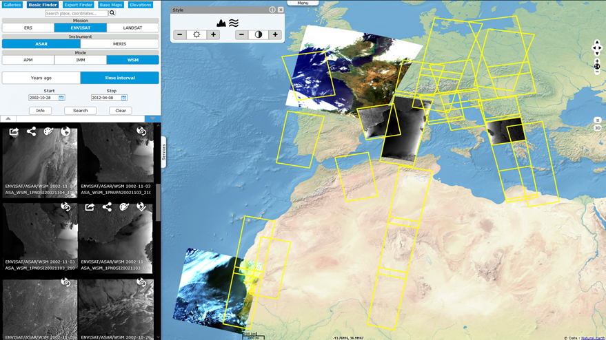
HEDAVI
Hosted service for viewing and sharing legacy data (ERS, Envisat satellites) and data from third party missions (Landsat) of the European Space Agency (ESA).
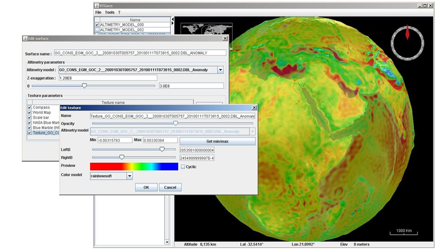
GSEP
Client-server system allowing to scan, visualise, share, export and choose the data rendering of the Goce satellite gravity measurements and the geomagnetic measurements of the three satellites of the Swarm constellation.